- Picaroons RoundhouseRun Host
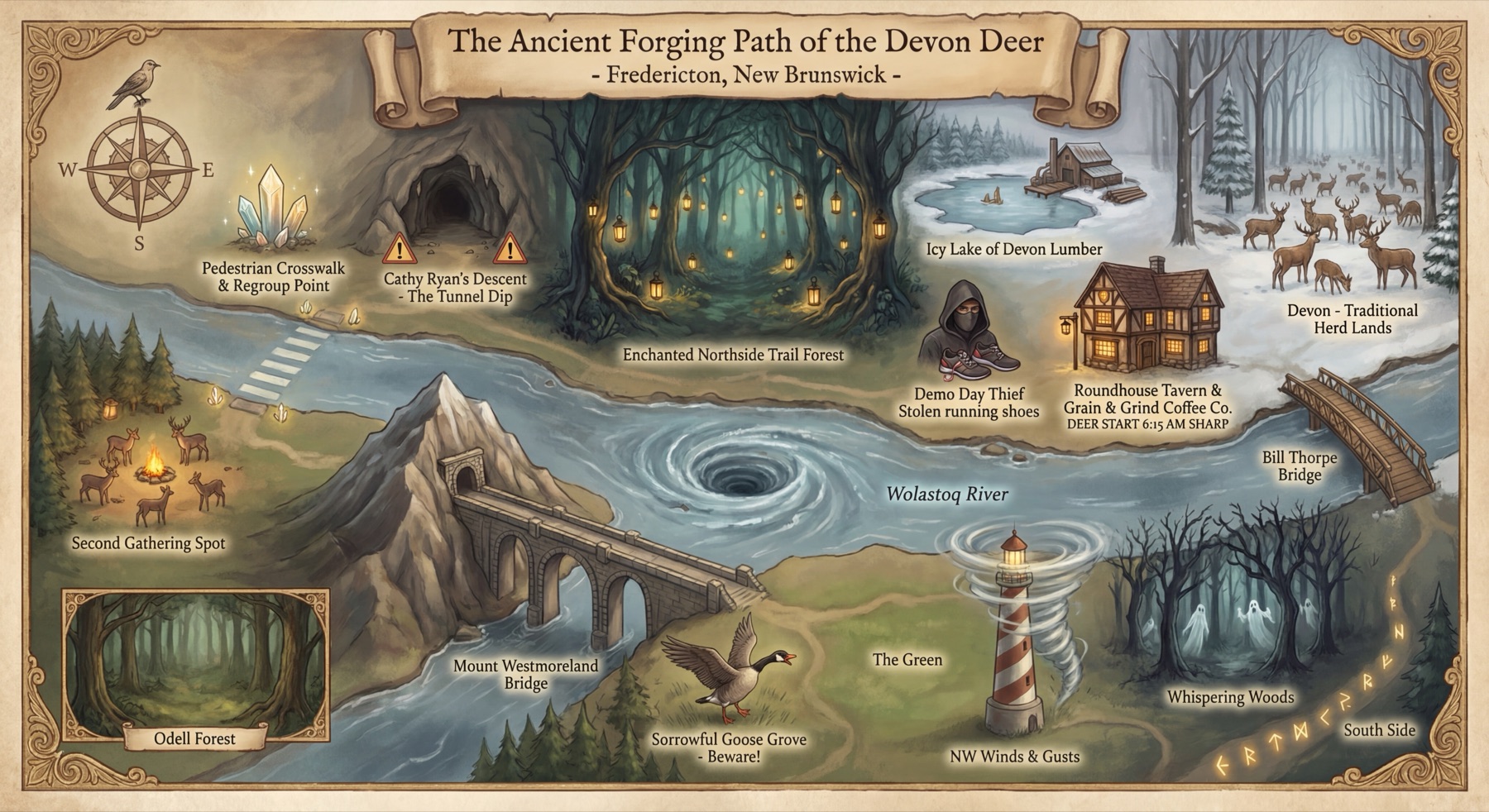
Welcome to Devon Deer, Fredericton’s most pixelated morning run club. We leave at 6:15 sharp. The fronty leads, the sweeper stays behind, and the photo begins with ‘cheesy noodles.’
- Icy Lake of Devon LumberRoute Scout
The bend by Devon Lumber can be slick. Shorten your stride. Heroics are optional.
- Northside TrailTrail Deer
This is the ancient foraging path, also known as the Northside Trail. Keep right, share the trail and settle into a pace at which you could still explain a full sentence.
- Cathy’s CraterCrater Keeper
Cathy’s Crater is the short dip near the tunnel. Watch your footing, especially in darkness or after rain, and enjoy a downhill that lasts approximately three seconds.
- First Regroup · Main StreetCrossing Guide
We regroup on the Northside Trail before crossing Main Street toward the Westmorland Bridge. Wait for the Run Host’s signal, look both ways and cross together without blocking the path.
- Westmorland Street BridgeBridge Guide
The herd uses the pedestrian sidewalk, never the traffic lanes. Keep right, leave room for others and stay aware. The bridge is the hill; nobody awards bonus points for sprinting it.
- Second Regroup · South BankRegroup Keeper
Second regroup, immediately after the south-bank bridge exit. Faster runners wait, and the final runner gets a real breather before the herd leaves together.
- Southside TrailRiver Trail Guide
We now turn onto the Southside Trail. Keep right, call passes gently and make room for walkers, cyclists and everyone else sharing the riverfront.
- Sorrowful Goose GroveSorrowful Goose
HONK. Give birds plenty of space, never surround them and let them choose their direction. Geese still have not accepted our all-paces policy.
- Lighthouse by 540Lighthouse Keeper
This riverside lighthouse is the Northwest Wind’s favourite territory. Relax your shoulders, shorten your stride a little and stay with the herd. The pixel tornado is theatrical and cannot slow you down.
- Crowne Plaza FrederictonVisiting Runner
In town for work or a conference? The route passes close to the Crowne Plaza Fredericton–Lord Beaverbrook. Visitors can simply show up and run with us.
- Beaverbrook Art GalleryGallery Guide
The Beaverbrook Art Gallery is our cultural landmark. Stay aware at driveways and crossings, and keep sharing the trail as the herd moves along downtown.
- The Green · Sir James Dunn FountainRiverfront Regular
The Green and Sir James Dunn fountain mark the final stretch. Bring the water you need; public fountains are landmarks, not guaranteed water stops.
- Bill Thorpe Walking BridgeWalking Bridge Keeper
The Bill Thorpe Walking Bridge is a narrow pedestrian crossing, quite different from the Westmorland road bridge. Keep right, share the space, then follow the herd home to Picaroons and coffee.
- Grain & GrindFinal Barista
Back at Picaroons. Grain & Grind is the final boss, except it serves coffee. Route complete. Nobody ran alone.